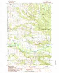
1985 Map of Stout Mountain
USGS Topo · Published 1985About this map
The Santiam River defines the southern portion of this mid-1980s landscape, marking the boundary between Marion and Linn Counties. The river's influence is evident at Stayton Island and the Upper Bennett Dam, while the Southern Pacific rail line follows the northern bank through the corridor. The terrain rises sharply to the north and east, transitioning from the agricultural flats near Valentine into the wooded heights of the Santiam State Forest and Silver Falls State Park.
Find a feature on this map
39 named features on this map. Tap any name to fly to it.
Don’t see what you’re looking for? This feature index may not catch every label — zoom into the map to look around manually.
Map Details
Editions of this 1985 Stout Mountain Map
This is the sole edition of this map. No revisions or reprints were ever made.
Other maps of this area

1921 · Lebanon
USGS Topo · 1:62,500

1922 · Lebanon
USGS Topo · 1:48,000

1924 · Lebanon
USGS Topo · 1:62,500

1925 · Stayton
USGS Topo · 1:62,500

1940 · Lebanon
USGS Topo · 1:62,500

1941 · Stayton
USGS Topo · 1:62,500

1944 · Lebanon
USGS Topo · 1:62,500

1951 · Lyons
USGS Topo · 1:62,500

1951 · Snow Peak
USGS Topo · 1:62,500

1953 · Salem
USGS Topo · 1:250,000