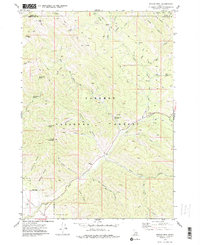
1977 Map of Stouts Mtn
USGS Topo · Published 1978About this map
Targhee National Forest defines this mountainous stretch along the boundary of Teton and Bonneville counties during the mid-1970s. The landscape is a complex of deep drainages and high points within the Big Hole Mountains, including named peaks like Liars Peak, Chicken Peak, and Black Mtn. Human activity is concentrated along several pack trails and specific seasonal outposts. Notable for genealogists and local historians is the West Pine Creek Girls Camp, situated near the headwaters of Pine Creek. The presence of numerous named springs, such as McCoullock Spring, Cold Spring, and Roy Farnes Spring, suggests the critical importance of reliable water sources for both forest management and early recreation in this high-altitude terrain. The map also records utilitarian features like a Borrow Pit and the specific paths of Gopher Canyon and Snowslide Gulch, illustrating the natural hazards and resource needs of the era.
Find a feature on this map
38 named features on this map. Tap any name to fly to it.
Don’t see what you’re looking for? This feature index may not catch every label — zoom into the map to look around manually.
Map Details
Editions of this 1977 Stouts Mtn Map
2 editions found
Other maps of this area

1932 · Irwin
USGS Topo · 1:96,000

1935 · Irwin
USGS Topo · 1:125,000

1943 · Driggs
USGS Topo · 1:62,500

1943 · Garns Mtn
USGS Topo · 1:62,500

1946 · Driggs
USGS Topo · 1:62,500

1946 · Garns Mtn
USGS Topo · 1:62,500

1955 · Driggs
USGS Topo · 1:250,000

1958 · Driggs
USGS Topo · 1:250,000

1962 · Driggs
USGS Topo · 1:250,000

1966 · Conant Valley
USGS Topo · 1:24,000