
1944 Map of Strafford
USGS Topo · Published 1949About this map
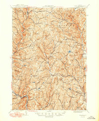
Industrial history in Orange and Windsor Counties is clearly defined by the copper mining operations that shaped these hills. The map highlights the Elizabeth Mine and the then-inactive Ely Mine, reflecting a landscape heavily influenced by mineral extraction. Beyond the mines, the region is defined by traditional Vermont valley settlements along the White River and the Ompompanoosuc River. These communities, including Chelsea, Strafford, and Tunbridge, are connected by a network of rural schools like Robinson Sch and Swanery Bean Sch.
Find a feature on this map
111 named features on this map. Tap any name to fly to it.
Don’t see what you’re looking for? This feature index may not catch every label — zoom into the map to look around manually.
Map Details
Editions of this 1944 Strafford Map
5 editions found
Other maps of this area

1896 · Strafford
USGS Topo · 1:62,500

1906 · Hanover
USGS Topo · 1:62,500

1908 · Hanover
USGS Topo · 1:62,500

1911 · Woodstock
USGS Topo · 1:62,500

1913 · Woodstock
USGS Topo · 1:62,500

1919 · Royalton
USGS Topo · 1:62,500

1922 · Barre
USGS Topo · 1:48,000

1924 · Barre
USGS Topo · 1:62,500

1924 · Randolph
USGS Topo · 1:48,000

1926 · Randolph
USGS Topo · 1:62,500