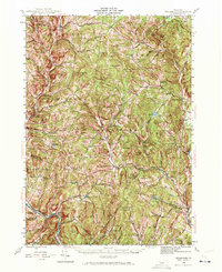
1944 Map of Strafford
USGS Topo · Published 1971About this map
White River tributaries and steep Vermont ridges define this mid-century landscape where industry and heritage intersect. The copper mining legacy of the region is clearly visible at the Elizabeth Mine and the Ely Mine (Inactive), reflecting the extraction history that shaped towns like South Strafford and Vershire. While these industrial sites mark the terrain, the cultural landscape is anchored by the Joseph Smith Monument near the southern border, a significant landmark in the town of Sharon.
Find a feature on this map
107 named features on this map. Tap any name to fly to it.
Don’t see what you’re looking for? This feature index may not catch every label — zoom into the map to look around manually.
Map Details
Editions of this 1944 Strafford Map
5 editions found

Other maps of this area

1896 · Strafford
USGS Topo · 1:62,500

1906 · Hanover
USGS Topo · 1:62,500

1908 · Hanover
USGS Topo · 1:62,500

1911 · Woodstock
USGS Topo · 1:62,500

1913 · Woodstock
USGS Topo · 1:62,500

1919 · Royalton
USGS Topo · 1:62,500

1922 · Barre
USGS Topo · 1:48,000

1924 · Barre
USGS Topo · 1:62,500

1924 · Randolph
USGS Topo · 1:48,000

1926 · Randolph
USGS Topo · 1:62,500