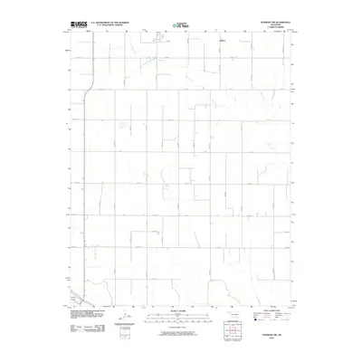
2010 Map of Straight SW
USGS Topo · Published 2010About this map
Mouser serves as the primary named point of reference in this corner of the Oklahoma Panhandle, situated within a vast grid of section roads that define the rural character of Texas County. The landscape is primarily shaped by the meandering course of Pony Creek as it winds through the northern and eastern sections, and Goff Creek which clips the southwestern corner. These ephemeral watercourses provide the only break in the geometric regularity of the county road system, where routes like Co Hwy 7 and Mile 35 Rd facilitate agricultural transport across the high plains. The map reflects a modern rural landscape where infrastructure is built around the 160-acre section divisions, a pattern typical of the region's late 20th-century development and land management.
Find a feature on this map
34 named features on this map. Tap any name to fly to it.
Don’t see what you’re looking for? This feature index may not catch every label — zoom into the map to look around manually.
Map Details
Editions of this 2010 Straight SW Map
This is the sole edition of this map. No revisions or reprints were ever made.
Other maps of this area

1954 · Perryton
USGS Topo · 1:250,000

1958 · Perryton
USGS Topo · 1:250,000

1967 · Straight
USGS Topo · 1:24,000

1967 · Straight NE
USGS Topo · 1:24,000

1967 · Straight SW
USGS Topo · 1:24,000

1967 · Optima
USGS Topo · 1:24,000

1968 · Guymon
USGS Topo · 1:24,000

1968 · Guymon NE
USGS Topo · 1:24,000

1973 · Hough NE
USGS Topo · 1:24,000

1973 · Goodwell NE
USGS Topo · 1:24,000