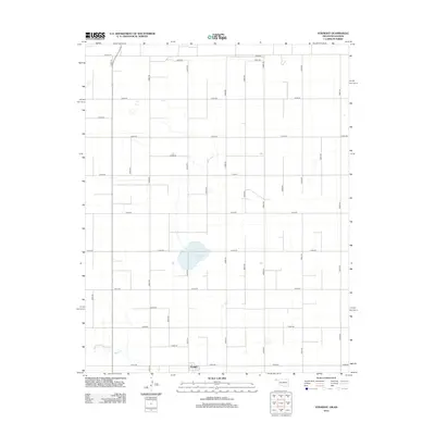
2012 Map of Straight
USGS Topo · Published 2012About this map
Straight sits at the southern edge of this Oklahoma Panhandle survey, a small settlement anchored by a grid of rural section roads. The landscape is defined by the ephemeral waters of Wild Horse Lake in the center of the quadrangle and the meandering path of Pony Cr in the southwest. A highly organized road network, including Co Hwy-11, Co Hwy-24, and Co Hwy-29, overlays the terrain, reflecting the systematic agricultural land divisions typical of Texas County. The map provides a clear look at the intersection of local transportation and the natural hydrology of the High Plains before the further modernization of the early 21st century.
Find a feature on this map
33 named features on this map. Tap any name to fly to it.
Don’t see what you’re looking for? This feature index may not catch every label — zoom into the map to look around manually.
Map Details
Editions of this 2012 Straight Map
This is the sole edition of this map. No revisions or reprints were ever made.
Other maps of this area

1954 · Perryton
USGS Topo · 1:250,000

1955 · Dodge City
USGS Topo · 1:250,000

1958 · Perryton
USGS Topo · 1:250,000

1958 · Dodge City
USGS Topo · 1:250,000

1959 · Dodge City
USGS Topo · 1:250,000

1967 · Straight
USGS Topo · 1:24,000

1967 · Straight NE
USGS Topo · 1:24,000

1967 · Straight SW
USGS Topo · 1:24,000

1967 · Optima
USGS Topo · 1:24,000

1973 · Hough NE
USGS Topo · 1:24,000