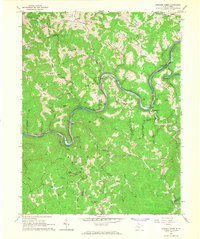
1965 Map of Strange Creek
USGS Topo · Published 1967About this map
The Elk River winds through the central Appalachians in this mid-1960s study, defining the boundary between Braxton and Clay counties. The landscape is characterized by a dense network of watercourses and deep hollows, where the Birch River meets the Elk at Glendon. The extractive economy of the era is clearly visible through numerous gas wells and oil wells scattered across the ridges, including concentrations near Bragg Knob and Snake Knob. Small rural settlements like Strange Creek and Servia serve as local hubs, connected by the Baltimore and Ohio railroad which tracks the river's path. Local life is anchored by community landmarks such as Villanova Ch, Valley Chapel, and the Flat Fork Sch, while several family burial grounds like Murphy Cem and Goad Cem provide essential data for those tracing local family roots in the region.
Find a feature on this map
65 named features on this map. Tap any name to fly to it.
Don’t see what you’re looking for? This feature index may not catch every label — zoom into the map to look around manually.
Map Details
Editions of this 1965 Strange Creek Map
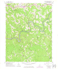
2 editions found
Other maps of this area

1889 · Nicholas
USGS Topo · 1:125,000

1891 · Nicholas
USGS Topo · 1:125,000

1893 · Sutton
USGS Topo · 1:125,000

1897 · Kanawha Falls
USGS Topo · 1:125,000

1900 · Kanawha Falls
USGS Topo · 1:125,000

1901 · Nicholas
USGS Topo · 1:125,000

1901 · Kanawha Falls
USGS Topo · 1:125,000

1906 · Otter
USGS Topo · 1:62,500

1907 · Otter
USGS Topo · 1:62,500

1908 · Clay
USGS Topo · 1:48,000