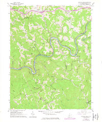
1965 Map of Strange Creek
USGS Topo · Published 1977About this map
The Elk River winds sharply through a deeply dissected landscape on this 1960s survey, updated in the mid-1970s. The region is defined by its winding waterways and the heavy presence of the Baltimore and Ohio railroad, which follows the river's path through settlements like Strange Creek and Glendon. This is a landscape of extraction and small-scale community, where numerous Gas Wells and Oil Wells are tucked into the hollows and along ridges like Wilson Ridge.
Find a feature on this map
70 named features on this map. Tap any name to fly to it.
Don’t see what you’re looking for? This feature index may not catch every label — zoom into the map to look around manually.
Map Details
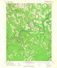
Editions of this 1965 Strange Creek Map
2 editions found
Other maps of this area

1889 · Nicholas
USGS Topo · 1:125,000

1891 · Nicholas
USGS Topo · 1:125,000

1893 · Sutton
USGS Topo · 1:125,000

1897 · Kanawha Falls
USGS Topo · 1:125,000

1900 · Kanawha Falls
USGS Topo · 1:125,000

1901 · Nicholas
USGS Topo · 1:125,000

1901 · Kanawha Falls
USGS Topo · 1:125,000

1906 · Otter
USGS Topo · 1:62,500

1907 · Otter
USGS Topo · 1:62,500

1908 · Clay
USGS Topo · 1:48,000