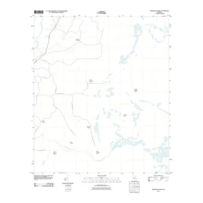
2011 Map of Strange Island
USGS Topo · Published 2011About this map
Harpers Hammock sits near the upper reaches of the Suwannee River, anchoring a landscape of intermittent wetlands and distinct highland rises. This 2011 survey documents a complex of terrain features within the Georgia swamp environment, where named islands such as Strange Island, North Strange Island, and Middle Strange Island emerge from the surrounding hydrology. These locations, along with Fiddlers Island and Little Fiddlers Island, suggest a history of seasonal use and specialized local geography.
Find a feature on this map
19 named features on this map. Tap any name to fly to it.
Don’t see what you’re looking for? This feature index may not catch every label — zoom into the map to look around manually.
Map Details
Editions of this 2011 Strange Island Map
This is the sole edition of this map. No revisions or reprints were ever made.
Other maps of this area

1954 · Valdosta
USGS Topo · 1:250,000

1955 · Council
USGS Topo · 1:24,000

1956 · Eddy
USGS Topo · 1:24,000

1956 · Sargent
USGS Topo · 1:24,000

1958 · Valdosta
USGS Topo · 1:250,000

1959 · Valdosta
USGS Topo · 1:250,000

1965 · Blackjack Island
USGS Topo · 1:24,000
1966 · Billys Island
USGS Topo · 1:24,000

1966 · The Pocket
USGS Topo · 1:24,000

1967 · Strange Island
USGS Topo · 1:24,000