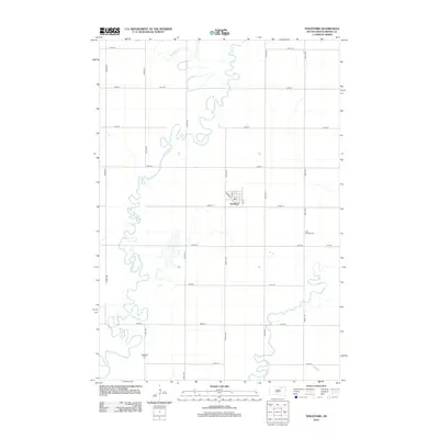
2012 Map of Stratford
USGS Topo · Published 2012About this map
The James River snakes through the central and western reaches of this landscape, its tight oxbows and wandering course defining the topography near Stratford. The town itself is organized around a traditional grid, where Railway St and numbered streets like 1st St and 5th St mark the center of local commerce and community. In the surrounding rural sections of East Rondell Township, a strictly geometric road network of numbered avenues and streets facilitates movement across the prairie. For those researching family history in Brown County, the map identifies local burial sites such as East Rondell Cem to the east and Oakwood Cem in the southwestern corner. Seasonal watercourses like Moccasin Cr and Mud Cr feed into the main river system, illustrating the hydrology of this agricultural region in the early twenty-first century.
Find a feature on this map
24 named features on this map. Tap any name to fly to it.
Don’t see what you’re looking for? This feature index may not catch every label — zoom into the map to look around manually.
Map Details
Editions of this 2012 Stratford Map
This is the sole edition of this map. No revisions or reprints were ever made.
Other maps of this area

1894 · Conde
USGS Topo · 1:62,500

1895 · Aberdeen
USGS Topo · 1:125,000

1953 · Brentford
USGS Topo · 1:24,000

1953 · Stratford
USGS Topo · 1:24,000

1953 · Groton SW
USGS Topo · 1:24,000

1953 · Warner
USGS Topo · 1:24,000

1954 · Bath
USGS Topo · 1:24,000

1954 · James
USGS Topo · 1:24,000

1954 · Mellette
USGS Topo · 1:24,000

1954 · Aberdeen
USGS Topo · 1:250,000