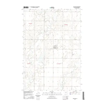
2015 Map of Stratford
USGS Topo · Published 2015About this map
The town of Stratford occupies the heart of this Brown County landscape, situated on a flat glacial plain where a grid of rural roads meets the meandering James River. This 2015 survey reveals a terrain defined by subtle drainage patterns, where Moccasin Cr joins the larger river system from the north while Mud Creek—also labeled as Mud Cr—flows in from the east. The settlement's street plan, including Railway Ave and Rondell Ave, suggests a layout historically tied to the regional rail corridors that once drove the local agricultural economy. For genealogists, the map identifies two significant sites: East Rondell Cem and Oakwood Cem, providing precise locations for these community landmarks. The vast section lines and townships, such as t121n r62w, underscore the enduring structure of the Public Land Survey System in South Dakota's farm country.
Find a feature on this map
31 named features on this map. Tap any name to fly to it.
Don’t see what you’re looking for? This feature index may not catch every label — zoom into the map to look around manually.
Map Details
Editions of this 2015 Stratford Map
This is the sole edition of this map. No revisions or reprints were ever made.
Other maps of this area

1894 · Conde
USGS Topo · 1:62,500

1895 · Aberdeen
USGS Topo · 1:125,000

1953 · Brentford
USGS Topo · 1:24,000

1953 · Stratford
USGS Topo · 1:24,000

1953 · Groton SW
USGS Topo · 1:24,000

1953 · Warner
USGS Topo · 1:24,000

1954 · Bath
USGS Topo · 1:24,000

1954 · James
USGS Topo · 1:24,000

1954 · Mellette
USGS Topo · 1:24,000

1954 · Aberdeen
USGS Topo · 1:250,000