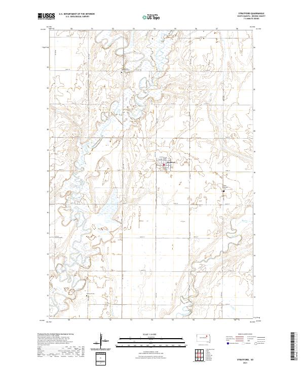
2021 Map of Stratford
USGS Topo · Published 2021About this map
The settlement of Stratford stands as a focal point in this portion of Brown County, where the grid of town streets like Campbell Ave and Railroad Ave meets the open agricultural landscape. The area is defined by the winding course of the James River, which meanders through the western half of the quadrangle, joined by tributaries such as Moccasin Cr and Mud Creek. These watercourses create a complex drainage pattern across the prairie, influencing the placement of early infrastructure and land use. For those researching local family history, several burial sites are clearly marked throughout the township, including Scandinavia Lutheran Cem to the north, East Rondell Cem near the eastern boundary, and Oakwood Cem in the southwest corner. The map documents a meticulously surveyed section of South Dakota, where the Public Land Survey System has dictated a precise network of section roads like 395th Ave and 143rd St.
Find a feature on this map
33 named features on this map. Tap any name to fly to it.
Don’t see what you’re looking for? This feature index may not catch every label — zoom into the map to look around manually.
Map Details
Editions of this 2021 Stratford Map
This is the sole edition of this map. No revisions or reprints were ever made.
Other maps of this area

1894 · Conde
USGS Topo · 1:62,500

1895 · Aberdeen
USGS Topo · 1:125,000

1953 · Brentford
USGS Topo · 1:24,000

1953 · Stratford
USGS Topo · 1:24,000

1953 · Groton SW
USGS Topo · 1:24,000

1953 · Warner
USGS Topo · 1:24,000

1954 · Bath
USGS Topo · 1:24,000

1954 · James
USGS Topo · 1:24,000

1954 · Mellette
USGS Topo · 1:24,000

1954 · Aberdeen
USGS Topo · 1:250,000