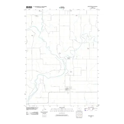
2010 Map of Stratford
USGS Topo · Published 2010About this map
The confluence of the Boone River and Des Moines River defines the central landscape of this Iowa survey, where several watercourses including Brushy Creek, Prairie Creek, and Squaw Creek carve through the agricultural grid. The town of Stratford serves as the primary settlement, anchored by the Stratford Post Office and connected to the surrounding countryside via HWY 175. This map preserves a detailed record of rural cemetery locations and family-named land features, which are vital for genealogical research in Hamilton and Webster counties.
Find a feature on this map
47 named features on this map. Tap any name to fly to it.
Don’t see what you’re looking for? This feature index may not catch every label — zoom into the map to look around manually.
Map Details
Editions of this 2010 Stratford Map
This is the sole edition of this map. No revisions or reprints were ever made.
Other maps of this area

1916 · Boone
USGS Topo · 1:62,500

1923 · Lehigh
USGS Topo · 1:62,500

1951 · Ogden
USGS Topo · 1:62,500

1954 · Waterloo
USGS Topo · 1:250,000

1954 · Fort Dodge
USGS Topo · 1:250,000

1955 · Waterloo
USGS Topo · 1:250,000

1957 · Fort Dodge
USGS Topo · 1:250,000

1958 · Fort Dodge
USGS Topo · 1:250,000

1965 · Mackey
USGS Topo · 1:24,000

1965 · Fraser
USGS Topo · 1:24,000