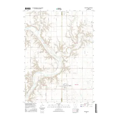
2015 Map of Stratford
USGS Topo · Published 2015About this map
Stratford serves as the primary hub at the southern edge of this landscape where Webster and Hamilton counties meet. The area is defined by the winding course of the Des Moines River, which carves deep valleys through the agricultural uplands, joined by the Boone River and smaller tributaries like Brushy Creek and Prairie Cr. This 2015 update preserves the locations of several important ancestral sites, including Oakwood Cem near the town center and the more secluded Vegars Cem and McGuire Cem situated along the river bends. To the north, the small settlement of Homer sits near the Homer Cem, illustrating the enduring nature of these rural communities. The intricate network of local routes, such as McGuire Bend Rd and Stagecoach Rd, provides a clear view of how modern transportation corridors follow the natural contours of the river valley and long-established property lines.
Find a feature on this map
71 named features on this map. Tap any name to fly to it.
Don’t see what you’re looking for? This feature index may not catch every label — zoom into the map to look around manually.
Map Details
Editions of this 2015 Stratford Map
This is the sole edition of this map. No revisions or reprints were ever made.
Other maps of this area

1916 · Boone
USGS Topo · 1:62,500

1923 · Lehigh
USGS Topo · 1:62,500

1951 · Ogden
USGS Topo · 1:62,500

1954 · Waterloo
USGS Topo · 1:250,000

1954 · Fort Dodge
USGS Topo · 1:250,000

1955 · Waterloo
USGS Topo · 1:250,000

1957 · Fort Dodge
USGS Topo · 1:250,000

1958 · Fort Dodge
USGS Topo · 1:250,000

1965 · Mackey
USGS Topo · 1:24,000

1965 · Fraser
USGS Topo · 1:24,000