2018 Map of Stratford
USGS Topo · Published 2018About this map
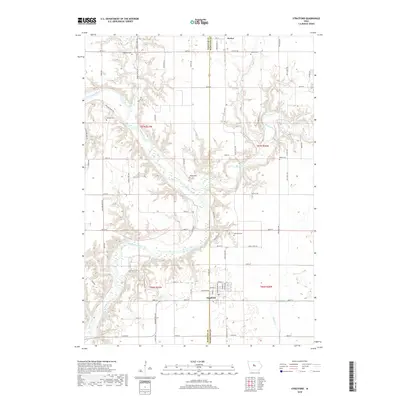
Stratford sits at the southern edge of this landscape, where the boundary between Webster Co and Hamilton Co meets. The town's grid is defined by streets named for literary figures such as Milton St, Shakespeare Ave, and Tennyson Ave. To the north, the small settlement of Homer marks the historic northern reach of the survey. The geography is dominated by the confluence of the Boone River and the Des Moines River, which carve deep, winding paths through the central part of the quadrangle. This riverine system creates a network of drainages including Prairie Cr and Allen Cr. Throughout the rural sections, several family and community burial sites are preserved, including Hartman Cem, Wegars Cem, and Nesse Cem, providing specific points of interest for those tracing local lineages or township history in central Iowa.
Find a feature on this map
64 named features on this map. Tap any name to fly to it.
Don’t see what you’re looking for? This feature index may not catch every label — zoom into the map to look around manually.
Map Details
Editions of this 2018 Stratford Map
This is the sole edition of this map. No revisions or reprints were ever made.
Other maps of this area

1916 · Boone
USGS Topo · 1:62,500

1923 · Lehigh
USGS Topo · 1:62,500

1951 · Ogden
USGS Topo · 1:62,500

1954 · Waterloo
USGS Topo · 1:250,000

1954 · Fort Dodge
USGS Topo · 1:250,000

1955 · Waterloo
USGS Topo · 1:250,000

1957 · Fort Dodge
USGS Topo · 1:250,000

1958 · Fort Dodge
USGS Topo · 1:250,000

1965 · Mackey
USGS Topo · 1:24,000

1965 · Fraser
USGS Topo · 1:24,000