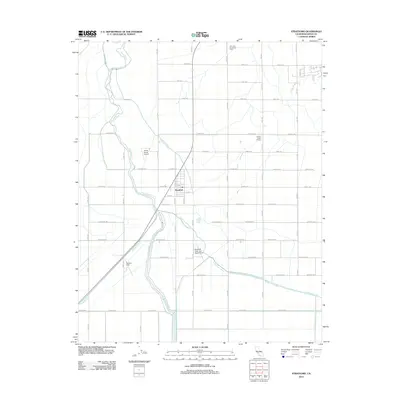
2012 Map of Stratford
USGS Topo · Published 2012About this map
Stratford serves as the central hub of this agricultural landscape in Kings County, where a complex network of irrigation and aviation supports the local economy. The town itself is compactly organized near the Stratford Canal and Kings River, which meanders through the western portion of the quadrangle. Significant agricultural infrastructure is visible, including the Avila And Fernandes Dairy and the Central Union Grange, reflecting the deep-rooted dairy and farming heritage of the region. The map reveals a high concentration of private aviation sites, such as Newton Field, Jones Farms Airport, and the Stratford Grain and Seed Airport, which facilitate large-scale crop management. A rigid grid of numbered avenues and named streets, from Jersey Ave to Nevada Ave, partitions the valley floor, intersected by essential waterways like the Tulare Lake Canal and Blakeley Canal that sustain the surrounding fields.
Find a feature on this map
38 named features on this map. Tap any name to fly to it.
Don’t see what you’re looking for? This feature index may not catch every label — zoom into the map to look around manually.
Map Details
Editions of this 2012 Stratford Map
This is the sole edition of this map. No revisions or reprints were ever made.
Other maps of this area

1926 · Hanford
USGS Topo · 1:31,680

1926 · Lethent
USGS Topo · 1:31,680

1927 · Lemoore
USGS Topo · 1:31,680

1929 · Guernsey
USGS Topo · 1:31,680

1929 · Stratford
USGS Topo · 1:31,680

1929 · Westhaven
USGS Topo · 1:31,680

1932 · El Rico Ranch
USGS Topo · 1:31,680

1933 · Kettleman City
USGS Topo · 1:31,680

1933 · Chatom Ranch
USGS Topo · 1:31,680
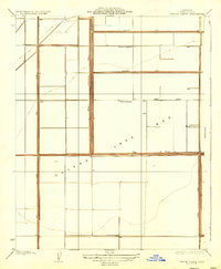
1935 · Chatom Ranch
USGS Topo · 1:31,680