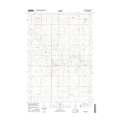
2015 Map of Stratford
USGS Topo · Published 2015About this map
The Big Eau Pleine River winds through this central Wisconsin landscape, anchoring a rural region defined by its small settlements and intersecting creeks. The village of Stratford serves as a central hub, where the local road network converges near the banks of Connor Mill Cr. Further north, the village of Fenwood sits along the Fenwood Cr drainage, representing the enduring small-town character of Marathon County. The map provides significant detail for genealogists and local historians, noting established landmarks like the Eau Pleine Cem and Zion Cem. The terrain is shaped by numerous watercourses, including Rock Cr and Wild Cr, which drain into the larger river system, reflecting the agricultural and hydrological patterns that have dictated local land use for generations.
Find a feature on this map
76 named features on this map. Tap any name to fly to it.
Don’t see what you’re looking for? This feature index may not catch every label — zoom into the map to look around manually.
Map Details
Editions of this 2015 Stratford Map
This is the sole edition of this map. No revisions or reprints were ever made.
Other maps of this area

1902 · Marathon
USGS Topo · 1:125,000

1953 · Marathon
USGS Topo · 1:48,000

1953 · Stratford
USGS Topo · 1:48,000

1953 · Eau Claire
USGS Topo · 1:250,000

1954 · Marshfield
USGS Topo · 1:62,500

1955 · Green Bay
USGS Topo · 1:250,000

1956 · Milladore
USGS Topo · 1:48,000

1958 · Eau Claire
USGS Topo · 1:250,000

1963 · Marathon
USGS Topo · 1:62,500

1963 · Stratford
USGS Topo · 1:62,500