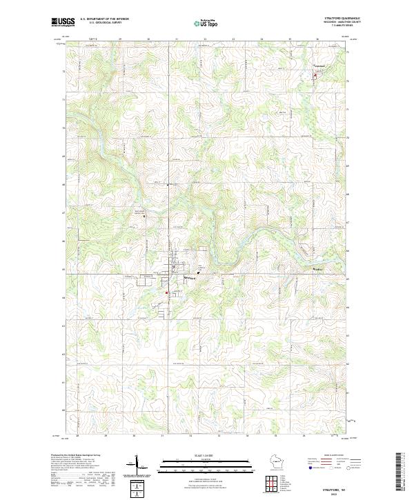
2022 Map of Stratford
USGS Topo · Published 2022About this map
The Big Eau Pleine River winds through this central Wisconsin landscape, anchoring the village of Stratford and the surrounding township. This modern survey illustrates the enduring agricultural and community structures of Marathon County, where family-named roads like Pioneer Dr and Seidel Rd intersect a landscape defined by small watercourses such as Hamann Cr and Rock Cr. Genealogy researchers will find significant value in the mapped religious and burial sites, including the Saint Joseph Catholic Cem north of town and the Zion Lutheran Cem located near the local Zion Ch. The map also captures the smaller settlements of Fenwood and Bradley, reflecting the localized clusters of homes and commerce that have persisted along these rural transit corridors.
Find a feature on this map
84 named features on this map. Tap any name to fly to it.
Don’t see what you’re looking for? This feature index may not catch every label — zoom into the map to look around manually.
Map Details
Editions of this 2022 Stratford Map
This is the sole edition of this map. No revisions or reprints were ever made.
Other maps of this area

1902 · Marathon
USGS Topo · 1:125,000

1953 · Marathon
USGS Topo · 1:48,000

1953 · Stratford
USGS Topo · 1:48,000

1953 · Eau Claire
USGS Topo · 1:250,000

1954 · Marshfield
USGS Topo · 1:62,500

1955 · Green Bay
USGS Topo · 1:250,000

1956 · Milladore
USGS Topo · 1:48,000

1958 · Eau Claire
USGS Topo · 1:250,000

1963 · Marathon
USGS Topo · 1:62,500

1963 · Stratford
USGS Topo · 1:62,500