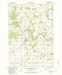
1981 Map of Stratford
USGS Topo · Published 1982About this map
The Big Eau Pleine River winds through the heart of this Marathon County landscape, serving as a geographic anchor for the townships of Eau Pleine and Cleveland. By the early 1980s, the village of Stratford had established a clear footprint south of the river, defined by its connection to the Chicago and North Western railroad and industrial features like the Water Tank and several Sew Disp Ponds. The map reveals a transition from these concentrated village centers to the surrounding agricultural grid, where small settlements like Fenwood and Bradley persist alongside local landmarks.
Find a feature on this map
37 named features on this map. Tap any name to fly to it.
Don’t see what you’re looking for? This feature index may not catch every label — zoom into the map to look around manually.
Map Details
Editions of this 1981 Stratford Map
This is the sole edition of this map. No revisions or reprints were ever made.
Other maps of this area

1902 · Marathon
USGS Topo · 1:125,000

1953 · Marathon
USGS Topo · 1:48,000

1953 · Stratford
USGS Topo · 1:48,000

1953 · Eau Claire
USGS Topo · 1:250,000

1954 · Marshfield
USGS Topo · 1:62,500

1955 · Green Bay
USGS Topo · 1:250,000

1956 · Milladore
USGS Topo · 1:48,000

1958 · Eau Claire
USGS Topo · 1:250,000

1963 · Marathon
USGS Topo · 1:62,500

1963 · Stratford
USGS Topo · 1:62,500