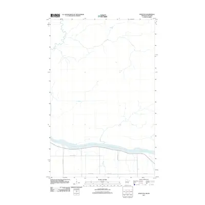
2011 Map of Stratton
USGS Topo · Published 2011About this map
Rainy River defines the southern boundary of this 2011 survey, marking the international border between Minnesota and Ontario. The landscape is characterized by a sparse, gridded road network north of the river, where several county routes such as County Hwy-88 and County Hwy-4 provide access to the rural northern interior. Along the waterway, McCloud Creek feeds into the main channel, illustrating the drainage patterns of this flat, borderland region. The map reflects a modern period of rural infrastructure, with the primary activity concentrated along the river corridor and major connectors like County Hwy-87.
Find a feature on this map
7 named features on this map. Tap any name to fly to it.
Don’t see what you’re looking for? This feature index may not catch every label — zoom into the map to look around manually.
Map Details
Editions of this 2011 Stratton Map
This is the sole edition of this map. No revisions or reprints were ever made.
Other maps of this area

1919 · Birchdale
USGS Topo · 1:62,500

1954 · Roseau
USGS Topo · 1:250,000

1957 · Roseau
USGS Topo · 1:250,000

1958 · Roseau
USGS Topo · 1:250,000

1968 · Birchdale SW
USGS Topo · 1:24,000

1968 · Birchdale SE
USGS Topo · 1:24,000

1968 · Stratton
USGS Topo · 1:24,000
1968 · Birchdale
USGS Topo · 1:24,000

1968 · Border
USGS Topo · 1:24,000

1968 · Clementson SE
USGS Topo · 1:24,000