
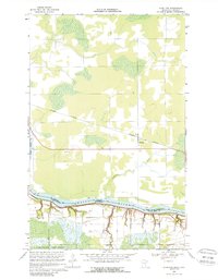
1968 Map of Stratton
USGS Topo · Published 1970About this map
The Rainy River serves as the international boundary between the United States and Canada in this northern borderland survey. On the Minnesota side, the landscape is defined by the extensive Pine Island State Forest and a series of small watercourses like McCloud Creek and Cameron Creek that drain northward into the river. The small settlement of Stratton sits along the Canadian National railroad line, which cuts across the terrain north of the river in Ontario. The presence of a Gravel Pit and a Sandpit near the shorelines suggests the local importance of aggregate extraction for road and rail maintenance in this rural corridor. This map captures the precise intersection of Koochiching County and the Rainy River District during the late 1960s, showing the early infrastructure and property lines that shaped this remote stretch of the border.
Find a feature on this map
11 named features on this map. Tap any name to fly to it.
Don’t see what you’re looking for? This feature index may not catch every label — zoom into the map to look around manually.
Map Details
Editions of this 1968 Stratton Map
2 editions found
Other maps of this area

1919 · Birchdale
USGS Topo · 1:62,500

1954 · Roseau
USGS Topo · 1:250,000

1957 · Roseau
USGS Topo · 1:250,000

1958 · Roseau
USGS Topo · 1:250,000

1968 · Birchdale SW
USGS Topo · 1:24,000

1968 · Birchdale SE
USGS Topo · 1:24,000
1968 · Birchdale
USGS Topo · 1:24,000

1968 · Border
USGS Topo · 1:24,000

1968 · Clementson SE
USGS Topo · 1:24,000
1976 · Baudette
USGS Topo · 1:100,000