
1968 Map of Border
USGS Topo · Published 1970About this map
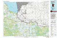
The Rainy River forms the international boundary between Ontario and Minnesota in this late-1960s survey, anchoring a landscape of remote settlements and timberlands. Small community centers such as Border, Frontier, Central, and Pinewood are connected by a mix of improved roads and a Winter Trail that cuts through the dense wetlands of the Pine Island State Forest. The presence of the Canadian National railroad corridor and local features like the Riverdale Cem suggest a history tied to the border-crossing economy and early land management. Much of the southern portion of the quadrangle is dominated by the marshy expanse of the Red Lake Indian Reservation, where the West Fork and Pinewood River drain into the primary river valley, illustrating the complex hydrology of the Minnesota north woods.
Find a feature on this map
18 named features on this map. Tap any name to fly to it.
Don’t see what you’re looking for? This feature index may not catch every label — zoom into the map to look around manually.
Map Details
Editions of this 1968 Border Map
This is the sole edition of this map. No revisions or reprints were ever made.
Other maps of this area

1919 · Birchdale
USGS Topo · 1:62,500

1954 · Roseau
USGS Topo · 1:250,000

1957 · Roseau
USGS Topo · 1:250,000

1958 · Roseau
USGS Topo · 1:250,000

1968 · Clementson
USGS Topo · 1:24,000

1968 · Birchdale SW
USGS Topo · 1:24,000

1968 · Stratton
USGS Topo · 1:24,000

1968 · Clementson SW
USGS Topo · 1:24,000

1968 · Clementson SE
USGS Topo · 1:24,000
1976 · Baudette
USGS Topo · 1:100,000