
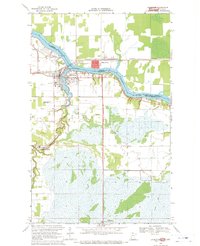
1968 Map of Clementson SW
USGS Topo · Published 1970About this map
The Rapid River and its tributary, the E Fk Rapid R, wind through a landscape defined by extensive wetlands and protected timberlands along the border of Lake of the Woods and Koochiching counties. This 1968 survey illustrates the complex geography of the Red Lake Indian Reservation, where various parcels of tribal land interleaf with the Pine Island State Forest. The presence of the named locality Bartons suggests a focal point of activity or habitation within an area otherwise dominated by the hydrological patterns of the river system. The map provides specific detail on the Forest Boundary and the many drainage brooks that characterize this northern Minnesota terrain, offering researchers a look at the land management and tribal boundaries prior to the 1970s.
Find a feature on this map
10 named features on this map. Tap any name to fly to it.
Don’t see what you’re looking for? This feature index may not catch every label — zoom into the map to look around manually.
Map Details
Editions of this 1968 Clementson SW Map
This is the sole edition of this map. No revisions or reprints were ever made.
Other maps of this area

1919 · Knutson
USGS Topo · 1:62,500

1921 · Baudette
USGS Topo · 1:62,500

1954 · Roseau
USGS Topo · 1:250,000

1957 · Roseau
USGS Topo · 1:250,000

1958 · Roseau
USGS Topo · 1:250,000

1968 · Baudette SE
USGS Topo · 1:24,000

1968 · Clementson
USGS Topo · 1:24,000

1968 · Border
USGS Topo · 1:24,000

1968 · Clementson SE
USGS Topo · 1:24,000
1968 · Baudette
USGS Topo · 1:24,000