
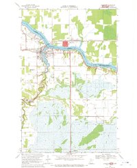
1968 Map of Clementson
USGS Topo · Published 1970About this map
Rainy River defines the international boundary between Ontario and Minnesota in this late 1960s survey. The settlement of Clementson is situated at the confluence of the river and Silver Creek, serving as a focal point for local families and early travelers. The geography reveals a transition from the structured movement of the Canadian National railroad in the north to the sprawling wetlands and timberlands of the Pine Island State Forest in the south.
Find a feature on this map
23 named features on this map. Tap any name to fly to it.
Don’t see what you’re looking for? This feature index may not catch every label — zoom into the map to look around manually.
Map Details
Editions of this 1968 Clementson Map
This is the sole edition of this map. No revisions or reprints were ever made.
Other maps of this area

1919 · Canada
USGS Topo · 1:62,500

1921 · Baudette
USGS Topo · 1:62,500

1954 · Roseau
USGS Topo · 1:250,000

1957 · Roseau
USGS Topo · 1:250,000

1958 · Roseau
USGS Topo · 1:250,000

1968 · Baudette SE
USGS Topo · 1:24,000

1968 · Border
USGS Topo · 1:24,000

1968 · Clementson SW
USGS Topo · 1:24,000

1968 · Clementson SE
USGS Topo · 1:24,000
1968 · Baudette
USGS Topo · 1:24,000