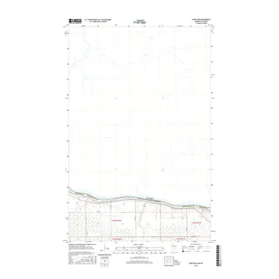
2016 Map of Stratton
USGS Topo · Published 2016About this map
The Rainy River defines the international boundary between the United States and Canada on this northern Minnesota landscape. In the southern portion of the map, the terrain is characterized by the low-lying wetlands of Koochiching County, where small drainages like McCloud Cr flow toward the primary river channel. The infrastructure is defined by a sparse grid of rural roads, including Co Hwy 4 and various county routes such as Co Rd 124 and Co Rd 153, which provide access to the surveyed sections of Township 160 North, Range 28 West and Township 160 North, Range 27 West. This survey highlights the intersection of international borders and the natural hydrography of the borderlands, showing how the river serves as both a physical barrier and a geographic anchor for the region.
Find a feature on this map
17 named features on this map. Tap any name to fly to it.
Don’t see what you’re looking for? This feature index may not catch every label — zoom into the map to look around manually.
Map Details
Editions of this 2016 Stratton Map
This is the sole edition of this map. No revisions or reprints were ever made.
Other maps of this area

1919 · Birchdale
USGS Topo · 1:62,500

1954 · Roseau
USGS Topo · 1:250,000

1957 · Roseau
USGS Topo · 1:250,000

1958 · Roseau
USGS Topo · 1:250,000

1968 · Birchdale SW
USGS Topo · 1:24,000

1968 · Birchdale SE
USGS Topo · 1:24,000

1968 · Stratton
USGS Topo · 1:24,000
1968 · Birchdale
USGS Topo · 1:24,000

1968 · Border
USGS Topo · 1:24,000

1968 · Clementson SE
USGS Topo · 1:24,000