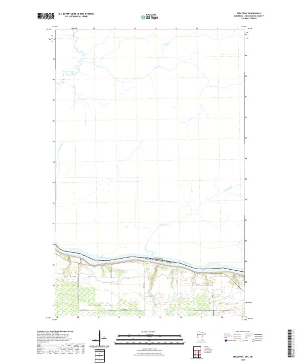
2022 Map of Stratton
USGS Topo · Published 2022About this map
The Rainy River forms the international boundary between the United States and Canada in this remote stretch of northern Minnesota. This landscape is defined by its extensive wetlands and the slow-moving drainage of the Pinewood River and Clement Cr, which wind through the northern half of the region. The southern portion of the map reveals the primary corridor for movement, where Co Hwy 4 and a network of county roads like Co Rd 88 and Co Rd 124 navigate the drier ground just south of the river. The lack of named settlements emphasizes the quiet, natural character of this Koochiching County frontier, where small tributaries like McCloud Cr and Cameron Cr feed into the prominent international waterway.
Find a feature on this map
18 named features on this map. Tap any name to fly to it.
Don’t see what you’re looking for? This feature index may not catch every label — zoom into the map to look around manually.
Map Details
Editions of this 2022 Stratton Map
This is the sole edition of this map. No revisions or reprints were ever made.
Other maps of this area

1919 · Birchdale
USGS Topo · 1:62,500

1954 · Roseau
USGS Topo · 1:250,000

1957 · Roseau
USGS Topo · 1:250,000

1958 · Roseau
USGS Topo · 1:250,000

1968 · Birchdale SW
USGS Topo · 1:24,000

1968 · Birchdale SE
USGS Topo · 1:24,000

1968 · Stratton
USGS Topo · 1:24,000
1968 · Birchdale
USGS Topo · 1:24,000

1968 · Border
USGS Topo · 1:24,000

1968 · Clementson SE
USGS Topo · 1:24,000