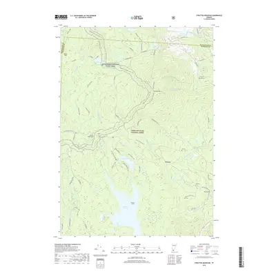
2018 Map of Stratton Mountain
USGS Topo · Published 2018About this map
Stratton Mtn and the surrounding wilderness of the Green Mountain National Forest dominate this 2018 survey, which highlights a landscape shaped by high-altitude terrain and outdoor recreation. The Appalachian National Scenic Trail winds through the region, intersecting with local routes like Corridor 7 and the Stratton-Arlington Rd. While much of the area is heavily forested, the map identifies small clusters of settlement such as Stratton and Pike Hollow, along with several historic burial sites including North Cem, Ball Cem, and Pike Cem. Large bodies of water like Somerset Reservoir, Grout Pond, and Stratton Pond provide essential landmarks in this drainage-heavy area, where the headwaters of the Deerfield River and Winhall River originate. The presence of specialized infrastructure like the Sports Cabin and various forest roads underscores the dual identity of this territory as both a managed timber resource and a premier recreation destination.
Find a feature on this map
62 named features on this map. Tap any name to fly to it.
Don’t see what you’re looking for? This feature index may not catch every label — zoom into the map to look around manually.
Map Details
Editions of this 2018 Stratton Mountain Map
This is the sole edition of this map. No revisions or reprints were ever made.
Other maps of this area

1889 · Wilmington
USGS Topo · 1:62,500

1891 · Wilmington
USGS Topo · 1:62,500

1894 · Londonderry
USGS Topo · 1:62,500

1894 · Equinox
USGS Topo · 1:62,500

1896 · Equinox
USGS Topo · 1:62,500

1898 · Bennington
USGS Topo · 1:62,500

1899 · Londonderry
USGS Topo · 1:62,500

1899 · Wilmington
USGS Topo · 1:62,500

1900 · Taconic
USGS Topo · 1:125,000

1900 · Equinox
USGS Topo · 1:62,500