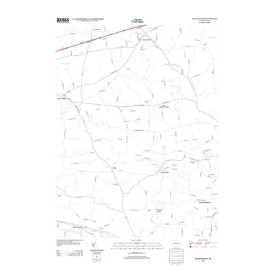
2013 Map of Strausstown
USGS Topo · Published 2013About this map
The Union Canal traces the southern edge of this landscape, a remnant of Pennsylvania's nineteenth-century transportation network that once connected the Susquehanna and Schuylkill rivers. In this part of Berks County, the water-driven history of the region is evident in the naming of Kricks Mill and Charming Forge, established near the banks of Tulpehocken Cr. The settlement pattern follows a series of long-standing crossroads and creek valleys, from the larger community of Strausstown in the north to Stouchsburg in the south. Smaller hamlets like Host and North Heidelberg punctuate the agricultural land, while more recent developments like Christmas Village sit alongside established waterways such as Little Northkill Cr and Little Swatara Cr. The map preserves the complex network of local roads, including Old 22 and Charming Forge RD, which linked these early industrial and farming centers.
Find a feature on this map
140 named features on this map. Tap any name to fly to it.
Don’t see what you’re looking for? This feature index may not catch every label — zoom into the map to look around manually.
Map Details
Editions of this 2013 Strausstown Map
This is the sole edition of this map. No revisions or reprints were ever made.
Other maps of this area

1889 · Pottsville
USGS Topo · 1:62,500

1891 · Pottsville
USGS Topo · 1:62,500

1891 · Lebanon
USGS Topo · 1:62,500

1892 · Pine Grove
USGS Topo · 1:62,500

1893 · Lebanon
USGS Topo · 1:62,500

1899 · Lebanon
USGS Topo · 1:62,500

1902 · Wernersville
USGS Topo · 1:62,500

1943 · Lebanon
USGS Topo · 1:62,500

1943 · Wernersville
USGS Topo · 1:62,500

1945 · Friedensburg
USGS Topo · 1:24,000
Featured Places
- Bethel Township, PA
- North Heidelberg Township, PA
- Strausstown, Upper Tulpehocken Township
- Upper Tulpehocken Township, PA
- Heidelberg Township, PA