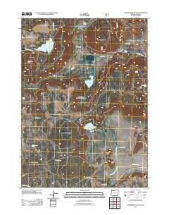
2011 Map of Strawberry Butte
USGS Topo · Published 2011About this map
Strawberry Reservoir and South Arm Reservoir anchor this high-elevation landscape within the U.S. Forest Service lands of Lake County. This 2011 survey reveals a remote ranching and water management network, where the Albertson Dam controls the Albertson Reservoir near the historic Albertson Ranch. The terrain is defined by prominent peaks including Strawberry Butte, Brushy Mountain, and Harp Mountain, with numerous water sources like Melix Spring and Adams Spring scattered throughout the valleys. A complex of seasonal drainages such as Strawberry Creek and the North Fork Willow Creek flow across the terrain, illustrating the critical importance of water rights and mountain grazing in the high desert interior. Local place names like Strawberry Flat and The Pothole suggest a landscape used primarily for livestock and watershed management during this era.
Find a feature on this map
33 named features on this map. Tap any name to fly to it.
Don’t see what you’re looking for? This feature index may not catch every label — zoom into the map to look around manually.
Map Details
Editions of this 2011 Strawberry Butte Map
This is the sole edition of this map. No revisions or reprints were ever made.
Other maps of this area

1886 · Alturas
USGS Topo · 1:250,000

1892 · Alturas
USGS Topo · 1:250,000

1954 · Alturas
USGS Topo · 1:250,000

1955 · Klamath Falls
USGS Topo · 1:250,000

1958 · Alturas
USGS Topo · 1:250,000

1958 · Klamath Falls
USGS Topo · 1:250,000

1960 · Strawberry Butte
USGS Topo · 1:62,500

1962 · Alturas
USGS Topo · 1:250,000

1962 · Steele Swamp
USGS Topo · 1:62,500

1962 · South Mountain
USGS Topo · 1:62,500