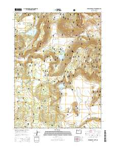
2014 Map of Strawberry Butte
USGS Topo · Published 2014About this map
Fremont National Forest defines this high-elevation landscape in Lake County, characterized by a complex network of seasonal water sources and volcanic terrain. Water management is central to the area, evidenced by the presence of Strawberry Reservoir, S Arm Reservoir, and Albertson Reservoir, which collect runoff from the surrounding peaks. Significant elevations like Strawberry Butte, Brushy Mtn, and Harp Mtn anchor the topography, while natural springs such as Willow Camp Spring, Adams Spring, and Helix Spring are scattered throughout the draws and flats. The map detail highlights the forest road system, including Barnes Valley Rd and the Natl Forest Develop Road 135, which facilitate access through this remote timber and grazing land. Local geographical markers like Yocum Valley, Squaw Flat, and a unique depression known as The Pothole provide specific points of interest for those studying the natural history of the Oregon high country.
Find a feature on this map
49 named features on this map. Tap any name to fly to it.
Don’t see what you’re looking for? This feature index may not catch every label — zoom into the map to look around manually.
Map Details
Editions of this 2014 Strawberry Butte Map
This is the sole edition of this map. No revisions or reprints were ever made.
Other maps of this area

1886 · Alturas
USGS Topo · 1:250,000

1892 · Alturas
USGS Topo · 1:250,000

1954 · Alturas
USGS Topo · 1:250,000

1955 · Klamath Falls
USGS Topo · 1:250,000

1958 · Alturas
USGS Topo · 1:250,000

1958 · Klamath Falls
USGS Topo · 1:250,000

1960 · Strawberry Butte
USGS Topo · 1:62,500

1962 · Alturas
USGS Topo · 1:250,000

1962 · Steele Swamp
USGS Topo · 1:62,500

1962 · South Mountain
USGS Topo · 1:62,500