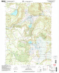
2004 Map of Strawberry Butte
USGS Topo · Published 2007About this map
The high-country ranching and timber landscape of Oregon's interior is documented in this 2004 revision, which details a rugged section of the Fremont National Forest. High peaks like Strawberry Butte and Harp Mountain overlook a complex network of water management features essential for livestock and forest health. The presence of Reed Ranch and numerous corrals near South Arm Reservoir indicates a persistent history of grazing in these uplands. Significant water resources, including the Albertson Reservoir and Strawberry Reservoir, are linked by high valleys such as Long Valley and Squaw Flat. This terrain is further defined by its isolated spring sites, such as Adams Spring and Sage Spring, which served as critical landmarks for early land users. The map also captures specialized land uses, from the industrial gravel pits to the artificial levees and the distinctive geological formation known as The Potholes.
Find a feature on this map
44 named features on this map. Tap any name to fly to it.
Don’t see what you’re looking for? This feature index may not catch every label — zoom into the map to look around manually.
Map Details
Editions of this 2004 Strawberry Butte Map
This is the sole edition of this map. No revisions or reprints were ever made.
Other maps of this area

1886 · Alturas
USGS Topo · 1:250,000

1892 · Alturas
USGS Topo · 1:250,000

1954 · Alturas
USGS Topo · 1:250,000

1955 · Klamath Falls
USGS Topo · 1:250,000

1958 · Alturas
USGS Topo · 1:250,000

1958 · Klamath Falls
USGS Topo · 1:250,000

1960 · Strawberry Butte
USGS Topo · 1:62,500

1962 · Alturas
USGS Topo · 1:250,000

1962 · Steele Swamp
USGS Topo · 1:62,500

1962 · South Mountain
USGS Topo · 1:62,500