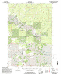
1995 Map of Strawberry Butte
USGS Topo · Published 1997About this map
Lewis and Clark National Forest encompasses this high-altitude landscape in Meagher County, where a complex network of tributaries feeds the region's major drainages. The area is defined by prominent peaks including Strawberry Butte, Black Butte, and Iron Butte, which served as critical landmarks for early surveyors and travelers. Evidence of historic resource extraction is visible through several Prospects located in the southern portion of the quadrangle near the headwaters of Black Butte Creek.
Find a feature on this map
23 named features on this map. Tap any name to fly to it.
Don’t see what you’re looking for? This feature index may not catch every label — zoom into the map to look around manually.
Map Details
Editions of this 1995 Strawberry Butte Map
This is the sole edition of this map. No revisions or reprints were ever made.
Other maps of this area

1886 · Fort Logan
USGS Topo · 1:250,000

1886 · Little Belt Mts.
USGS Topo · 1:250,000

1894 · Little Belt Mts.
USGS Topo · 1:250,000

1897 · Little Belt Mts.
USGS Topo · 1:250,000

1898 · Little Belt Mts.
USGS Topo · 1:250,000

1902 · Little Belt Mts.
USGS Topo · 1:250,000

1948 · White Sulphur Springs
USGS Topo · 1:250,000

1958 · White Sulphur Springs
USGS Topo · 1:250,000

1961 · White Sulphur Springs
USGS Topo · 1:250,000

1965 · White Sulphur Springs
USGS Topo · 1:250,000