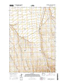
2017 Map of Strawberry Canyon SE
USGS Topo · Published 2017About this map
Strawberry Canyon and the surrounding high desert terrain of Morrow County define this landscape as it appeared in recent years. This area is characterized by a network of drainage features like Sand Hollow and Milk Canyon, which carve through the plateau. A deep agricultural and military history is evident in the road names, specifically Bombing Range Rd and local connectors such as Kilkenny Rd, Cutsforth Rd, and Nichols Rd. These routes often follow the established section lines of the Public Land Survey System, as seen in the grid-like placement of Baseline Ln. A small but significant site for family researchers is the Sand Hollow Cem located on the eastern edge of the quadrangle, serving as a quiet focal point for this rural expanse.
Find a feature on this map
27 named features on this map. Tap any name to fly to it.
Don’t see what you’re looking for? This feature index may not catch every label — zoom into the map to look around manually.
Map Details
Editions of this 2017 Strawberry Canyon SE Map
This is the sole edition of this map. No revisions or reprints were ever made.
Other maps of this area

1906 · Blalock Island
USGS Topo · 1:125,000

1908 · Blalock Island
USGS Topo · 1:125,000

1908 · Umatilla
USGS Topo · 1:125,000

1953 · Pendleton
USGS Topo · 1:250,000

1956 · Pendleton
USGS Topo · 1:250,000

1968 · Service Buttes NW
USGS Topo · 1:24,000

1968 · Swaggart Buttes
USGS Topo · 1:24,000

1968 · Lexington
USGS Topo · 1:24,000

1968 · Gleason Butte
USGS Topo · 1:24,000

1968 · Butter Creek Junction
USGS Topo · 1:24,000