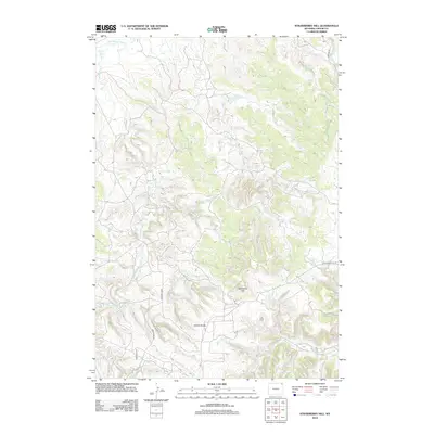
2012 Map of Strawberry Hill
USGS Topo · Published 2012About this map
Stawberry Hill and the Goldie Divide dominate this corner of Crook County, where the high plains terrain is defined by a network of drainage creeks. The Little Missouri River enters at the northern edge, fed by watercourses including Elkhorn Cr, Lindsey Cr, and Bronco John Cr. This landscape is sparsely settled, characterized by ranching infrastructure such as the Foster Reservoir and a grid of rural access routes like Lobban Rd and Mewhirter Rd. The map illustrates the specialized water management and roadway network necessary for navigating this expansive part of northeastern Wyoming. Researchers can trace the path of Sourdough Cr as it winds through the southern reaches of the quadrangle near Strawberry Hill Rd.
Find a feature on this map
12 named features on this map. Tap any name to fly to it.
Don’t see what you’re looking for? This feature index may not catch every label — zoom into the map to look around manually.
Map Details
Editions of this 2012 Strawberry Hill Map
This is the sole edition of this map. No revisions or reprints were ever made.
Other maps of this area

1905 · Devils Tower
USGS Topo · 1:125,000

1954 · Strawberry Hill
USGS Topo · 1:24,000

1954 · Storm Hill
USGS Topo · 1:24,000

1954 · Gillette
USGS Topo · 1:250,000

1955 · Devils Tower
USGS Topo · 1:62,500

1955 · Gillette
USGS Topo · 1:250,000

1957 · Oshoto
USGS Topo · 1:62,500

1957 · Seely
USGS Topo · 1:62,500

1957 · Cedar Ridge
USGS Topo · 1:62,500

1958 · Gillette
USGS Topo · 1:250,000