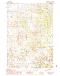
1984 Map of Strawberry Hill
USGS Topo · Published 1985About this map
Strawberry Hill dominates the southeastern quadrant of this northeastern Wyoming landscape, marking a terrain of sharp divides and winding creek beds in the early 1980s. The northwest is defined by the Little Missouri River, where a system of levee structures indicates early water management efforts along its banks. Resource extraction and aviation are notably present, with the operations of a Uranium Mine located near the center of the sheet and the Tromble Ranch Airfield situated to the east. The drainage pattern is dense, featuring named water bodies such as Elkhorn Creek, Tie Creek, and Sourdough Creek, while the Goldie Divide provides a clear geographic boundary in the south. This area reflects a mid-century period of mixed land use, where ranching and mining infrastructure exist alongside significant natural features like Lindsey Creek and Bronco John Creek.
Find a feature on this map
19 named features on this map. Tap any name to fly to it.
Don’t see what you’re looking for? This feature index may not catch every label — zoom into the map to look around manually.
Map Details
Editions of this 1984 Strawberry Hill Map
This is the sole edition of this map. No revisions or reprints were ever made.
Other maps of this area

1905 · Devils Tower
USGS Topo · 1:125,000

1954 · Strawberry Hill
USGS Topo · 1:24,000

1954 · Storm Hill
USGS Topo · 1:24,000

1954 · Gillette
USGS Topo · 1:250,000

1955 · Devils Tower
USGS Topo · 1:62,500

1955 · Gillette
USGS Topo · 1:250,000

1957 · Oshoto
USGS Topo · 1:62,500

1957 · Seely
USGS Topo · 1:62,500

1957 · Cedar Ridge
USGS Topo · 1:62,500

1958 · Gillette
USGS Topo · 1:250,000