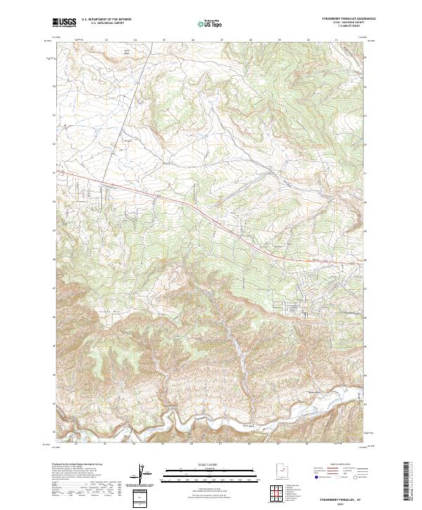
2023 Map of Strawberry Pinnacles
USGS Topo · Published 2023About this map
The Strawberry River carves a deep path through this corner of Duchesne County, defining a landscape dominated by high plateaus and complex drainage systems. To the west, the prominent elevation of Cedar Mtn anchors the terrain, while the river valley below is fed by a network of seasonal watercourses including Garden Wash, Ethlen Wash, and the notably named Hoodoo Canyon. These geological features suggest a region shaped by significant erosion, typical of the Uintah Basin's rugged geography.
Find a feature on this map
40 named features on this map. Tap any name to fly to it.
Don’t see what you’re looking for? This feature index may not catch every label — zoom into the map to look around manually.
Map Details
Editions of this 2023 Strawberry Pinnacles Map
This is the sole edition of this map. No revisions or reprints were ever made.
Other maps of this area

1885 · Uinta
USGS Topo · 1:250,000

1954 · Salt Lake City
USGS Topo · 1:250,000

1958 · Salt Lake City
USGS Topo · 1:250,000

1960 · Salt Lake City
USGS Topo · 1:250,000

1962 · Strawberry Pinnacles
USGS Topo · 1:24,000
1962 · Buck Knoll
USGS Topo · 1:24,000
1962 · Sams Canyon
USGS Topo · 1:24,000

1962 · Blacktail Mtn
USGS Topo · 1:24,000

1962 · Fruitland
USGS Topo · 1:24,000

1962 · Tabiona
USGS Topo · 1:24,000