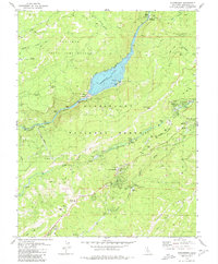
1979 Map of Strawberry
USGS Topo · Published 1980About this map
Stanislaus National Forest serves as the backdrop for this late 1970s survey, dominated by the hydroelectric and timber landscape of the Stanislaus River forks. The intricate engineering of the era is on display via the Beardsley Lake reservoir, supported by a network of infrastructure including the Spring Gap Powerhouse, several Gaging Stations, and a series of aqueducts, flumes, and penstocks. These features illustrate the managed water systems critical to California's mountain interior.
Find a feature on this map
57 named features on this map. Tap any name to fly to it.
Don’t see what you’re looking for? This feature index may not catch every label — zoom into the map to look around manually.
Map Details
Editions of this 1979 Strawberry Map
2 editions found
Other maps of this area

1891 · Big Trees
USGS Topo · 1:125,000

1894 · Big Trees
USGS Topo · 1:125,000

1896 · Dardanelles
USGS Topo · 1:125,000

1897 · Big Trees
USGS Topo · 1:125,000

1898 · Dardanelles
USGS Topo · 1:125,000

1901 · Big Trees
USGS Topo · 1:125,000

1947 · Sacramento
USGS Topo · 1:250,000

1948 · Walker Lake
USGS Topo · 1:250,000

1948 · Sacramento
USGS Topo · 1:250,000

1956 · Sacramento
USGS Topo · 1:250,000