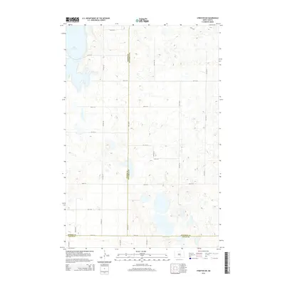
2014 Map of Streeter NW
USGS Topo · Published 2014About this map
Lake George dominates the northwestern corner of this landscape, part of a sprawling network of prairie potholes and wetlands that define the Missouri Coteau. This 2014 survey documents a remote section of the North Dakota plains where three counties—Kidder, Stutsman, and Logan—meet in a complex of section lines and gravel roads. The terrain is characterized by high-density glacial depressions, many containing unnamed seasonal ponds or semi-permanent sloughs. A grid of rural corridors, including 47th Ave SE and 52nd St SE, provides the only structural framework across the undulating topography, reflecting the enduring township-and-range surveying system that has organized this agricultural region since settlement.
Find a feature on this map
22 named features on this map. Tap any name to fly to it.
Don’t see what you’re looking for? This feature index may not catch every label — zoom into the map to look around manually.
Map Details
Editions of this 2014 Streeter NW Map
This is the sole edition of this map. No revisions or reprints were ever made.
Other maps of this area

1952 · Tappen SE
USGS Topo · 1:24,000

1953 · Jamestown
USGS Topo · 1:250,000

1955 · Medina SW
USGS Topo · 1:24,000

1955 · Medina SE
USGS Topo · 1:24,000

1956 · Jamestown
USGS Topo · 1:250,000

1975 · Medina SW
USGS Topo · 1:24,000

1983 · Streeter SW
USGS Topo · 1:24,000

1983 · Streeter
USGS Topo · 1:24,000

1983 · Alkaline Lake
USGS Topo · 1:24,000

1983 · Streeter NW
USGS Topo · 1:24,000