
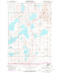
1952 Map of Tappen SE
USGS Topo · Published 1954About this map
Glacial potholes and prairie wetlands define the topography of this Kidder County landscape, captured just as the Northern Pacific railroad continued to serve as the region's primary transport artery. The northwestern corner of the map features the outskirts of Tappen, where a defined Village Boundary separates the burgeoning settlement from the expansive agricultural sections of Crystal Springs and Tanner.
Find a feature on this map
9 named features on this map. Tap any name to fly to it.
Don’t see what you’re looking for? This feature index may not catch every label — zoom into the map to look around manually.
Map Details
Editions of this 1952 Tappen SE Map
This is the sole edition of this map. No revisions or reprints were ever made.
Other maps of this area

1952 · Tappen South
USGS Topo · 1:24,000

1952 · Tappen NE
USGS Topo · 1:24,000

1952 · Tappen North
USGS Topo · 1:24,000

1953 · Jamestown
USGS Topo · 1:250,000

1955 · Crystal Springs
USGS Topo · 1:24,000

1955 · Medina SW
USGS Topo · 1:24,000

1956 · Jamestown
USGS Topo · 1:250,000
1975 · Tappen North
USGS Topo · 1:24,000

1975 · Medina SW
USGS Topo · 1:24,000

1983 · Alkaline Lake
USGS Topo · 1:24,000