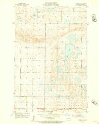
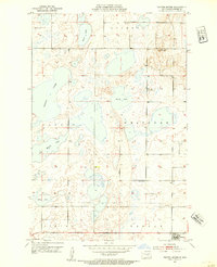
1952 Map of Tappen NE
USGS Topo · Published 1954About this map
Salt Alkaline Lake dominates this prairie landscape in Kidder County, illustrating the complex hydrology of North Dakota's pothole region in the early 1950s. The southern edge of the map features the industrial corridor of the Northern Pacific railroad, which supported the development of Tappen and the small station at Ladoga. This survey, conducted under the administration of Governor C. Norman Brunsdale, captures a rural society organized around small district institutions like School No 1 and School No 2. Further north, the presence of Camp Whitney State Park on the shores of Sweetwater Lake highlights early state efforts toward conservation and recreation amidst the agricultural townships of Westford, Buckeye, and Crystal Springs. The map’s fine-grained detail, including Kleiter Slough and various unnamed prairie potholes, reflects a landscape shaped by glacial activity.
Find a feature on this map
14 named features on this map. Tap any name to fly to it.
Don’t see what you’re looking for? This feature index may not catch every label — zoom into the map to look around manually.
Map Details
Editions of this 1952 Tappen NE Map
2 editions found
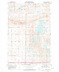
Other maps of this area
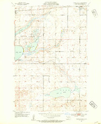
1952 · Tappen South
USGS Topo · 1:24,000
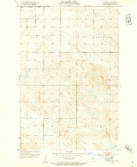
1952 · Tappen SE
USGS Topo · 1:24,000
1952 · Tappen North
USGS Topo · 1:24,000

1952 · New Rockford
USGS Topo · 1:250,000

1953 · Jamestown
USGS Topo · 1:250,000
1955 · Crystal Springs
USGS Topo · 1:24,000

1955 · Medina SW
USGS Topo · 1:24,000

1956 · New Rockford
USGS Topo · 1:250,000

1956 · Jamestown
USGS Topo · 1:250,000

1971 · New Rockford
USGS Topo · 1:250,000