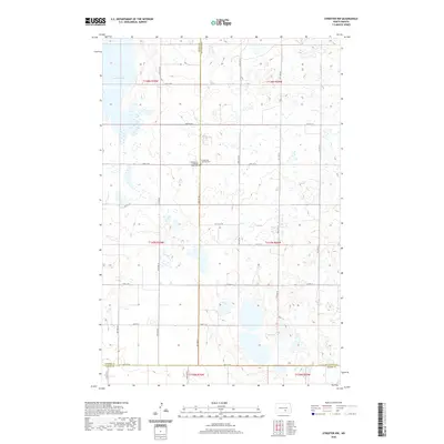
2020 Map of Streeter NW
USGS Topo · Published 2020About this map
The rolling prairie of the North Dakota interior is defined here by a network of glacial wetlands and the rural boundaries of the Missouri Plateau. Lake George dominates the northwest corner of the terrain, while the landscape is dotted with numerous unnamed prairie potholes and depressions typical of the region. The map captures the intersection of Kidder, Stutsman, and Logan counties, illustrating the precise section lines of the Public Land Survey System. Genealogical interest is centered on the Evangelical Lutheran Cem and the Evangelical Lutheran Split Cem, which sit near the central county line. This grid of section roads, including Co Hwy 37 and 54th St Se, facilitates access to the remote farmsteads and agricultural plots that have shaped the local economy for generations.
Find a feature on this map
23 named features on this map. Tap any name to fly to it.
Don’t see what you’re looking for? This feature index may not catch every label — zoom into the map to look around manually.
Map Details
Editions of this 2020 Streeter NW Map
This is the sole edition of this map. No revisions or reprints were ever made.
Other maps of this area

1952 · Tappen SE
USGS Topo · 1:24,000

1953 · Jamestown
USGS Topo · 1:250,000

1955 · Medina SW
USGS Topo · 1:24,000

1955 · Medina SE
USGS Topo · 1:24,000

1956 · Jamestown
USGS Topo · 1:250,000

1975 · Medina SW
USGS Topo · 1:24,000

1983 · Streeter SW
USGS Topo · 1:24,000

1983 · Streeter
USGS Topo · 1:24,000

1983 · Alkaline Lake
USGS Topo · 1:24,000

1983 · Streeter NW
USGS Topo · 1:24,000