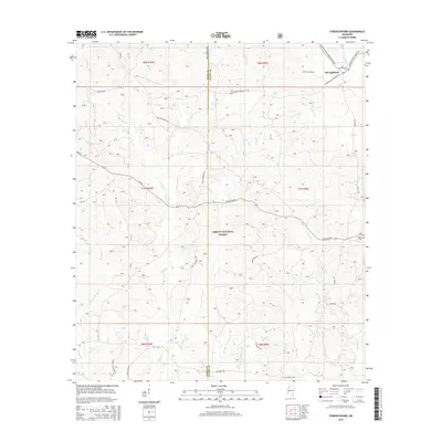
2015 Map of Strengthford
USGS Topo · Published 2015About this map
The DeSoto National Forest dominates this landscape along the border of Jones and Wayne counties, where a dense network of forest roads and creek-bed crossings defines the rural layout. Small settlements like Strengthford are connected by historically rooted paths such as Old Culpepper Rd and Strengthford-Bankston Rd. Local genealogy is anchored by the Strengthford Cem and Salem Cem, which serve as quiet landmarks for the surrounding communities. The terrain is deeply carved by numerous water systems, including Tiger Cr, Thompson Cr, and their various branches. This drainage pattern, featuring names like Gully Br and W Little Thompson Cr, illustrates the hydrological complexity that dictated land use and road placement in this part of Mississippi.
Find a feature on this map
42 named features on this map. Tap any name to fly to it.
Don’t see what you’re looking for? This feature index may not catch every label — zoom into the map to look around manually.
Map Details
Editions of this 2015 Strengthford Map
This is the sole edition of this map. No revisions or reprints were ever made.
Other maps of this area

1953 · Hattiesburg
USGS Topo · 1:250,000

1958 · Hattiesburg
USGS Topo · 1:250,000

1964 · Rhodes
USGS Topo · 1:24,000

1964 · Laurel East
USGS Topo · 1:24,000

1964 · Ovett
USGS Topo · 1:24,000

1964 · Myrick
USGS Topo · 1:24,000

1964 · Strengthford
USGS Topo · 1:24,000

1964 · Mulberry
USGS Topo · 1:24,000

1964 · Whistler
USGS Topo · 1:24,000

1964 · Lanham
USGS Topo · 1:24,000