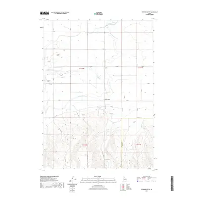
2020 Map of Stricker Butte
USGS Topo · Published 2020About this map
The Twin Falls Main Canal and High Line North Canal define the agricultural irrigation patterns of this Idaho landscape south of the Snake River. The settlement of Rock Creek serves as a central point in this transition zone where the structured grid of the Snake River Plain meets the rising elevations of the South Hills. Genealogy researchers can find the Rock Creek Cem situated north of the community near the winding path of Rock Creek. To the west, Stricker Butte rises above the fields, while the terrain grows increasingly complex as it moves south toward Dry Gulch and Niles Gulch. The map records a modern network of county roads, including Indian Spring Rd and Cherry Spring Rd, which navigate the gullies and valleys like Pleasant Valley and Antelope Valley.
Find a feature on this map
34 named features on this map. Tap any name to fly to it.
Don’t see what you’re looking for? This feature index may not catch every label — zoom into the map to look around manually.
Map Details
Editions of this 2020 Stricker Butte Map
This is the sole edition of this map. No revisions or reprints were ever made.
Other maps of this area

1955 · Twin Falls
USGS Topo · 1:250,000

1958 · Twin Falls
USGS Topo · 1:250,000

1964 · Kimberly
USGS Topo · 1:24,000

1964 · Twin Falls
USGS Topo · 1:24,000

1964 · Eden
USGS Topo · 1:24,000

1965 · Rams Horn Ridge
USGS Topo · 1:24,000

1965 · Stricker Butte
USGS Topo · 1:24,000

1965 · Grand View Peak
USGS Topo · 1:24,000

1965 · Hub Butte
USGS Topo · 1:24,000

1965 · Murtaugh
USGS Topo · 1:24,000