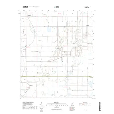
2018 Map of Stringtown
USGS Topo · Published 2018About this map
Bee Bayou and Stillwater Bayou thread through the lowlands of Washington and Bolivar Counties, defining a landscape of agricultural tracts and scattered family settlements in 2018. The map centers on Stringtown, with Grapeland and Meltonia marking the northern reaches of the quadrangle. This delta region is dotted with significant local landmarks for family researchers, including Dickerson Cem, Asia Cem, and Mount Cozy Cem near the central crossroads.
Find a feature on this map
57 named features on this map. Tap any name to fly to it.
Don’t see what you’re looking for? This feature index may not catch every label — zoom into the map to look around manually.
Map Details
Editions of this 2018 Stringtown Map
This is the sole edition of this map. No revisions or reprints were ever made.
Other maps of this area

1933 · Lamont
USGS Topo · 1:62,500

1939 · Refuge
USGS Topo · 1:62,500

1939 · Lamont
USGS Topo · 1:62,500

1939 · Tralake
USGS Topo · 1:62,500

1939 · Choctaw
USGS Topo · 1:62,500

1953 · Greenwood
USGS Topo · 1:250,000

1956 · Greenwood
USGS Topo · 1:250,000

1967 · Stringtown
USGS Topo · 1:24,000
1967 · Skene
USGS Topo · 1:24,000

1967 · Leland
USGS Topo · 1:24,000