
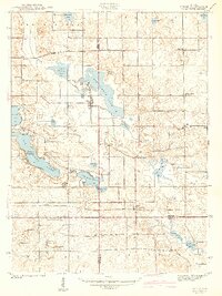
1942 Map of Stroh
USGS Topo · Published 1942About this map
Glacial lakes and small agricultural settlements define this portion of Northeast Indiana during the early 1940s. The village of Stroh serves as a central point between Big Turkey Lake and Big Long Lake, where shorelines are dotted with landings like Wildwood Landing and Werts Landing. The landscape is a complex network of wetlands and drainage features, including Stump Ditch and Maumee Ditch, which connect numerous smaller bodies of water such as McClish Lake and Lake of the Woods.
Find a feature on this map
48 named features on this map. Tap any name to fly to it.
Don’t see what you’re looking for? This feature index may not catch every label — zoom into the map to look around manually.
Map Details
Editions of this 1942 Stroh Map
2 editions found
Other maps of this area

1940 · Orland
USGS Topo · 1:24,000

1941 · Orland
USGS Topo · 1:24,000

1941 · Angola West
USGS Topo · 1:24,000

1942 · Ashley
USGS Topo · 1:24,000

1942 · Angola West
USGS Topo · 1:24,000

1947 · Mongo
USGS Topo · 1:24,000

1947 · Wolcottville
USGS Topo · 1:24,000

1953 · Fort Wayne
USGS Topo · 1:250,000

1955 · Corunna
USGS Topo · 1:24,000

1955 · Kendallville
USGS Topo · 1:24,000