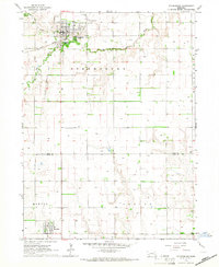
1965 Map of Stromsburg
USGS Topo · Published 1966About this map
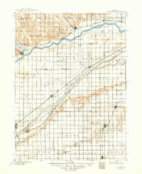
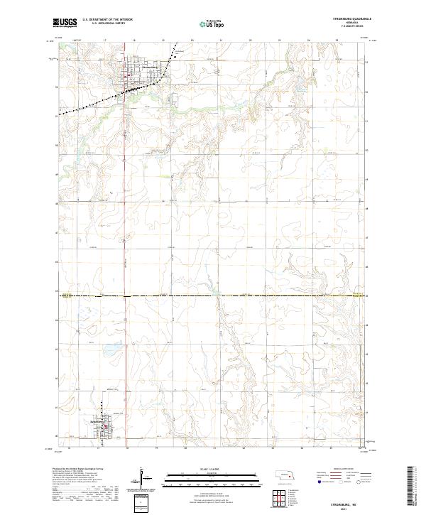
The Big Blue River winds through the northern portion of this Nebraska landscape, where the settlement of Stromsburg serves as a primary hub of activity in the mid-1960s. The town’s orderly street grid is complemented by community landmarks such as Buckley Park, the Stromsburg Cem, and the nearby Stromsburg Airport. This survey provides a clear look at the agricultural infrastructure of the era, punctuated by numerous agricultural wells and the transition from active rail lines to legacy transport routes. While the Union Pacific tracks continue to serve the region, an Old Railroad Grade further south indicates the shifting patterns of rural transit. In the southern reaches across the Polk Co York Co line, the village of Benedict sits as a smaller collection of residences and structures surrounded by the surveyed townships of Morton and Thayer.
Find a feature on this map
16 named features on this map. Tap any name to fly to it.
Don’t see what you’re looking for? This feature index may not catch every label — zoom into the map to look around manually.
Map Details
Editions of this 1965 Stromsburg Map
This is the sole edition of this map. No revisions or reprints were ever made.
Historical Maps of Stromsburg Through Time
6 maps found