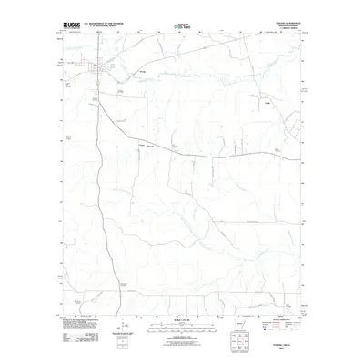
2011 Map of Strong
USGS Topo · Published 2011About this map
The Strong Oil Field anchors the northern landscape of this Union County quadrangle, situated near the settlement of Strong. The area is characterized by a network of rural routes and creek systems, including South Lapile Creek and the North Fork Frank Lapere Creek, which drain the timbered and oil-rich grounds of southern Arkansas. The map reveals a high density of rural burial grounds, such as Pilgrims Rest Cemetery, Hughes Cemetery, and Good Hope Cemetery, which serve as vital markers for genealogical research in these small communities. Small population centers like Victoria, Union, and Lapile are connected by local roads like Jones Lake Cutoff and State Line Rd, the latter tracing the border where Arkansas meets Louisiana. The interplay of industrial resource extraction and traditional community landmarks defines this region's modern character.
Find a feature on this map
48 named features on this map. Tap any name to fly to it.
Don’t see what you’re looking for? This feature index may not catch every label — zoom into the map to look around manually.
Map Details
Editions of this 2011 Strong Map
This is the sole edition of this map. No revisions or reprints were ever made.
Other maps of this area

1933 · Strong
USGS Topo · 1:62,500

1934 · Felsenthal
USGS Topo · 1:62,500

1935 · Haile
USGS Topo · 1:62,500

1937 · Strong
USGS Topo · 1:62,500

1937 · Felsenthal
USGS Topo · 1:62,500

1938 · Felsenthal
USGS Topo · 1:62,500

1939 · Felsenthal
USGS Topo · 1:62,500

1939 · Strong
USGS Topo · 1:62,500

1952 · Farmerville
USGS Topo · 1:62,500

1953 · El Dorado
USGS Topo · 1:250,000