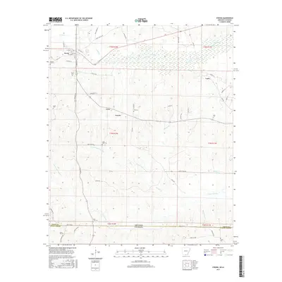
2017 Map of Strong
USGS Topo · Published 2017About this map
Strong sits as a central hub in the northern reach of this quadrangle, where a street grid including 1st Ave and Railroad St signals its development along the rail corridor. The landscape is defined by the intricate drainages of S Lapile Cr and the branching forks of Frank Lapere Cr, which flow through the timbered terrain toward the Arkansas Louisiana state line. This borderland region is characterized by a high density of small rural burial grounds, including Pilgrims Rest Cem, Sweet Home Cem, and Good Hope Cem, reflecting a long-settled community of family farms and small crossroad hamlets like Victoria and Lapile. Numerous parish and union roads, such as Oklona Rd and New London Rd, create a dense network connecting these outlying settlements through the hills and creek bottoms.
Find a feature on this map
65 named features on this map. Tap any name to fly to it.
Don’t see what you’re looking for? This feature index may not catch every label — zoom into the map to look around manually.
Map Details
Editions of this 2017 Strong Map
This is the sole edition of this map. No revisions or reprints were ever made.
Other maps of this area

1933 · Strong
USGS Topo · 1:62,500

1934 · Felsenthal
USGS Topo · 1:62,500

1935 · Haile
USGS Topo · 1:62,500

1937 · Strong
USGS Topo · 1:62,500

1937 · Felsenthal
USGS Topo · 1:62,500

1938 · Felsenthal
USGS Topo · 1:62,500

1939 · Felsenthal
USGS Topo · 1:62,500

1939 · Strong
USGS Topo · 1:62,500

1952 · Farmerville
USGS Topo · 1:62,500

1953 · El Dorado
USGS Topo · 1:250,000