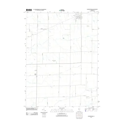
2012 Map of Stronghurst
USGS Topo · Published 2012About this map
Stronghurst serves as a central hub in this section of Henderson County, where the street grid is anchored by W Main St and S Broadway St. The surrounding landscape is defined by a dense network of waterways, including Honey Cr, Dugout Cr, and the La Moine River, which carve through the agricultural tablelands of Western Illinois. Small unincorporated settlements and named rural localities like Terre Haute and Decorra reveal the early 21st-century distribution of communities that were once vital railroad or stage stops. Genealogists will find significant value in the documentation of local burial grounds, such as Peasley Cem, Terre Haute Cem, and Old Bedford Cem, which are preserved alongside local landmarks like Neff Airport. The township road system, including routes like Evans Feedlot Rd and Ted Rockeffer Rd, illustrates the continued importance of livestock and agriculture to the local economy.
Find a feature on this map
32 named features on this map. Tap any name to fly to it.
Don’t see what you’re looking for? This feature index may not catch every label — zoom into the map to look around manually.
Map Details
Editions of this 2012 Stronghurst Map
This is the sole edition of this map. No revisions or reprints were ever made.
Other maps of this area

1918 · La Harpe
USGS Topo · 1:62,500

1932 · Lomax
USGS Topo · 1:62,500

1934 · Oquawka
USGS Topo · 1:48,000

1934 · Burlington
USGS Topo · 1:48,000

1937 · Lomax
USGS Topo · 1:62,500

1940 · Oquawka
USGS Topo · 1:62,500

1940 · Burlington
USGS Topo · 1:62,500

1958 · Burlington
USGS Topo · 1:250,000

1961 · Burlington
USGS Topo · 1:250,000

1963 · Burlington
USGS Topo · 1:250,000