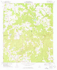
1974 Map of Strouds
USGS Topo · Published 1976About this map
The community of Strouds sits at the center of this 1970s landscape, positioned where the Lamar Co Monroe Co boundary line meets the rural road network. The map reveals a transitioning agricultural area defined by family-named landmarks and ecclesiastical history, from Sharon Ch to the New Macedonia Ch. Industrial traces are evident near the western border with a Quarry and Mine Dump, while transportation history is etched into the terrain by the Southern railroad line and sections of an Old RR Grade.
Find a feature on this map
37 named features on this map. Tap any name to fly to it.
Don’t see what you’re looking for? This feature index may not catch every label — zoom into the map to look around manually.
Map Details
Editions of this 1974 Strouds Map
This is the sole edition of this map. No revisions or reprints were ever made.
Other maps of this area

1951 · Yatesville
USGS Topo · 1:62,500

1951 · Forsyth
USGS Topo · 1:62,500

1951 · Barnesville
USGS Topo · 1:62,500

1953 · Atlanta
USGS Topo · 1:250,000

1953 · Athens
USGS Topo · 1:250,000

1955 · Phenix City
USGS Topo · 1:250,000

1956 · Bolingbroke
USGS Topo · 1:62,500

1957 · Phenix City
USGS Topo · 1:250,000

1957 · Macon
USGS Topo · 1:250,000

1957 · Atlanta
USGS Topo · 1:250,000